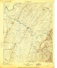
1901 Map of Cleveland
USGS Topo · Published 1921About this map
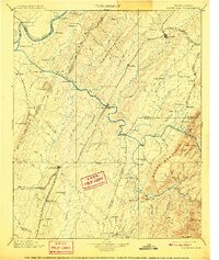
The Hiwassee River serves as the central artery for this late nineteenth-century portrait of Bradley, McMinn, and Polk Counties. While the Tennessee River curves along the western boundary near Bells Landing, the Hiwassee facilitates a dense network of river-crossing infrastructure, including Tucker Ferry, Kincannon Ferry, and Raht Ferry. The industrial and agricultural development of the region is anchored by Cleveland and Athens, connected by the Southern R.R. and the Nashville Tennessee and Charleston R.R. To the east, the terrain rises sharply into the Cherokee National Forest, dominated by Beans Mountain and Oswald Dome. Local centers of commerce such as Chestuee Mills and Longs Mills highlight the importance of water power along the smaller creeks, while Helderbrand Ford provides critical passage across the Ocoee River south of Benton.
Find a feature on this map
137 named features on this map. Tap any name to fly to it.
Don’t see what you’re looking for? This feature index may not catch every label — zoom into the map to look around manually.
Map Details
Editions of this 1901 Cleveland Map
4 editions found

Other maps of this area

1886 · Dalton
USGS Topo · 1:125,000

1886 · Cleveland
USGS Topo · 1:125,000

1886 · Ringgold
USGS Topo · 1:125,000

1887 · Kingston
USGS Topo · 1:125,000

1888 · Ellijay
USGS Topo · 1:125,000

1888 · Chattanooga
USGS Topo · 1:125,000

1891 · Kingston
USGS Topo · 1:125,000

1892 · Pikeville
USGS Topo · 1:125,000

1892 · Ringgold
USGS Topo · 1:125,000

1892 · Cleveland
USGS Topo · 1:125,000