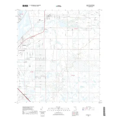
2018 Map of Cleveland
USGS Topo · Published 2018About this map
Cleveland and the residential neighborhoods of Sans Souci and Ridge Harbor sit at the confluence where Shell Creek meets the tidal Peace River. This coastal landscape is defined by its extensive drainage networks and aviation infrastructure, with both the Punta Gorda Airport and Shell Creek Airpark serving the region. The interior is characterized by dense wetlands and water management features like Myrtle Slough and the uniquely named Between the Grades Lake. Local history and genealogy interest is anchored by the Cleveland Cem near the river and the Royal Palm Memorial Gardens further south. The map illustrates a community shaped by the Florida coastline, where residential development like Tee and Green Estates is intricately tied to the surrounding prairie creeks and alligator-named waterways.
Find a feature on this map
109 named features on this map. Tap any name to fly to it.
Don’t see what you’re looking for? This feature index may not catch every label — zoom into the map to look around manually.
Map Details
Editions of this 2018 Cleveland Map
This is the sole edition of this map. No revisions or reprints were ever made.
Other maps of this area

1956 · Arcadia SE
USGS Topo · 1:24,000

1956 · Murdock SE
USGS Topo · 1:24,000

1956 · Cleveland
USGS Topo · 1:24,000

1956 · Ft. Ogden
USGS Topo · 1:24,000

1956 · Punta Gorda SE
USGS Topo · 1:24,000

1956 · Bermont
USGS Topo · 1:24,000

1956 · West Palm Beach
USGS Topo · 1:250,000

1956 · Tampa
USGS Topo · 1:250,000

1956 · Fort Pierce
USGS Topo · 1:250,000

1956 · Charlotte Harbor
USGS Topo · 1:250,000