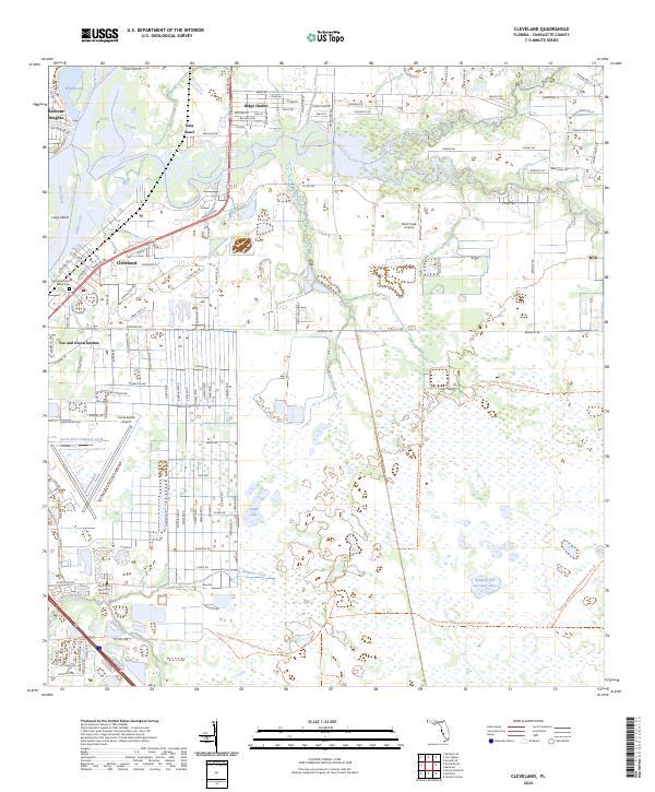
2024 Map of Cleveland
USGS Topo · Published 2024About this map
Peace River and its southern tributaries define the landscape of this Florida Gulf Coast region, where residential communities meet vast conservation lands. The settlements of Harbour Heights, Sans Souci, and Cleveland occupy the higher ground near the riverbanks, interspersed with local landmarks like Bailey Cem and the Shell Mound archaeological site. To the east and south, the terrain transitions into a complex hydrological network of sloughs and prongs, including Myrtle Slough and the North Prong Alligator Creek.
Find a feature on this map
131 named features on this map. Tap any name to fly to it.
Don’t see what you’re looking for? This feature index may not catch every label — zoom into the map to look around manually.
Map Details
Editions of this 2024 Cleveland Map
This is the sole edition of this map. No revisions or reprints were ever made.
Other maps of this area

1956 · Arcadia SE
USGS Topo · 1:24,000

1956 · Murdock SE
USGS Topo · 1:24,000

1956 · Cleveland
USGS Topo · 1:24,000

1956 · Ft. Ogden
USGS Topo · 1:24,000

1956 · Punta Gorda SE
USGS Topo · 1:24,000

1956 · Bermont
USGS Topo · 1:24,000

1956 · West Palm Beach
USGS Topo · 1:250,000

1956 · Tampa
USGS Topo · 1:250,000

1956 · Fort Pierce
USGS Topo · 1:250,000

1956 · Charlotte Harbor
USGS Topo · 1:250,000