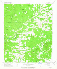
1962 Map of Cleveland
USGS Topo · Published 1963About this map
Cleveland and the surrounding borderlands between Van Buren and Conway counties are defined by the winding hydrology of Point Remove Creek and its diverse tributaries. At this time in the early 1960s, the landscape is a patchwork of small upland communities and rural landmarks, including the high ground at Gravel Hill and the distinct geography of The Narrows. Family and community history is deeply rooted here, evidenced by the numerous small burial grounds and rural houses of worship such as Moores Chapel, Liberty Springs Church, and Upchurch Cemetery. Significant topographical features like Money Mountain, Lick Mountain, and Egger Mountain rise above the stream valleys of Sucker Creek and Canady Branch, illustrating the complex terrain of the Ozark National Forest. Red dashed lines throughout the quadrangle denote contemporary fence and field lines, offering a glimpse into the land-use patterns and agricultural boundaries of the era.
Find a feature on this map
50 named features on this map. Tap any name to fly to it.
Don’t see what you’re looking for? This feature index may not catch every label — zoom into the map to look around manually.
Map Details
Editions of this 1962 Cleveland Map
2 editions found
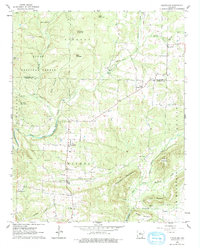
Other maps of this area

1879 · Washington
USGS Topo · 1:62,500

1887 · Smyrna
USGS Topo · 1:62,500

1889 · Marshall #3
USGS Topo · 1:62,500

1892 · Marshall
USGS Topo · 1:125,000

1892 · Morrillton
USGS Topo · 1:125,000

1894 · Morrillton
USGS Topo · 1:125,000

1894 · Marshall
USGS Topo · 1:125,000

1901 · Marshall
USGS Topo · 1:125,000

1940 · Smyrna
USGS Topo · 1:62,500
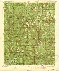
1943 · Smyrna
USGS Topo · 1:62,500