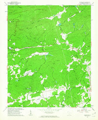
1961 Map of Cleveland
USGS Topo · Published 1963About this map
Middle Saluda River and its various forks dominate this 1961 portrait of the Greenville and Pickens county line, where the landscape transitions from high mountain peaks to river-cut valleys. The area is characterized by a high concentration of recreational and youth camps established in the mid-century, including Civitan Camp, Camp Parker, and Camp Stanley Harris. These sites, along with landmarks like Caesars Head and Bald Rock, suggest the region's long-standing role as a mountain retreat and recreational corridor north of the larger Piedmont cities.
Find a feature on this map
67 named features on this map. Tap any name to fly to it.
Don’t see what you’re looking for? This feature index may not catch every label — zoom into the map to look around manually.
Map Details
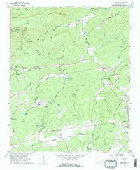
Editions of this 1961 Cleveland Map
2 editions found
Other maps of this area

1888 · Pickens
USGS Topo · 1:125,000

1894 · Pickens
USGS Topo · 1:125,000

1905 · Pisgah
USGS Topo · 1:125,000

1906 · Pisgah
USGS Topo · 1:125,000

1907 · Saluda
USGS Topo · 1:125,000

1935 · Brevard
USGS Topo · 1:24,000

1935 · Standingstone Mtn.
USGS Topo · 1:24,000

1935 · Greenville
USGS Topo · 1:48,000

1935 · Table Rock
USGS Topo · 1:24,000

1935 · Zirconia
USGS Topo · 1:24,000