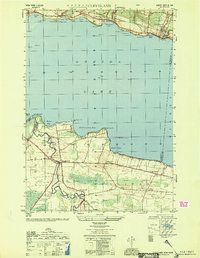
1951 Map of Cleveland
USGS Topo · Published 1951About this map
Oneida Lake dominates this mid-century landscape, serving as a critical navigation corridor via the Barge Canal Route. Along the northern shore, the New York Central and Hudson River railroad connects the waterfront villages of Constantia, Bernhards Bay, and Cleveland. These settlements are characterized by their proximity to the water, where numerous points and bays like Dakin Bay and Bernhard Bay define the shoreline.
Find a feature on this map
61 named features on this map. Tap any name to fly to it.
Don’t see what you’re looking for? This feature index may not catch every label — zoom into the map to look around manually.
Map Details
Editions of this 1951 Cleveland Map
This is the sole edition of this map. No revisions or reprints were ever made.
Other maps of this area

1895 · Chittenango
USGS Topo · 1:62,500

1895 · Syracuse
USGS Topo · 1:62,500

1898 · Syracuse
USGS Topo · 1:62,500

1898 · Chittenango
USGS Topo · 1:62,500

1902 · Chittenango
USGS Topo · 1:62,500

1905 · Mexico
USGS Topo · 1:62,500

1906 · Kasoag
USGS Topo · 1:62,500

1938 · Syracuse East
USGS Topo · 1:24,000

1940 · Cicero
USGS Topo · 1:24,000

1941 · Cleveland
USGS Topo · 1:24,000