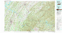
1981 Map of Cleveland
USGS Topo · Published 1981About this map
Cleveland serves as a primary hub in the Ridge-and-Valley province of East Tennessee, situated amidst the prominent north-south trending ridges like Mouse Creek Ridge and Lead Ridge. The landscape is defined by its deep connection to water and industry, with the Hiwassee River and Tennessee River forming major corridors for the Hiwassee Wildlife Refuge and the expansive Chickamauga Lake. Further east, the terrain rises sharply into the Unicoi Mountains and Blue Ridge, where the copper-mining legacy of the Copper Basin is evident around Ducktown and Copperhill. Transport networks including the Southern RR and the Louisville and Nashville RR link established valley settlements like Athens, Etowah, and Charleston, illustrating the historical reliance on rail for moving timber and minerals from the Cherokee National Forest.
Find a feature on this map
150 named features on this map. Tap any name to fly to it.
Don’t see what you’re looking for? This feature index may not catch every label — zoom into the map to look around manually.
Map Details
Editions of this 1981 Cleveland Map
2 editions found
Other maps of this area

1886 · Dalton
USGS Topo · 1:125,000

1886 · Cleveland
USGS Topo · 1:125,000

1886 · Knoxville
USGS Topo · 1:125,000

1886 · Ringgold
USGS Topo · 1:125,000

1886 · Dahlonega
USGS Topo · 1:125,000

1887 · Kingston
USGS Topo · 1:125,000

1888 · Ellijay
USGS Topo · 1:125,000

1888 · Chattanooga
USGS Topo · 1:125,000

1891 · Kingston
USGS Topo · 1:125,000

1892 · Pikeville
USGS Topo · 1:125,000