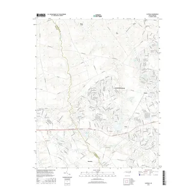
2016 Map of Clifdale
USGS Topo · Published 2016About this map
Fayetteville expands westward into the Sandhills region of North Carolina in this mid-2010s survey, showing a landscape defined by the convergence of residential growth and large-scale military infrastructure. The boundary between Cumberland Co and Hoke Co bisects the terrain, where established communities like Clifdale and Rockfish sit alongside newer developments. The presence of Yadkin Rd, Mac Ridge Rd, and Chicken Rd highlights the area's intricate road network connecting various ridges and valleys. Water features such as Lake Rim, Hutaff Lake, and Lake Williams are central to the local geography, serving as focal points for the surrounding neighborhoods. Elevations like Vaughn Hill and Caisson Hill provide relief in the north, while the southern portion is drained by Little Rockfish Cr and Stewarts Cr, reflecting the natural drainage patterns that have historically shaped settlement in this part of the coastal plain.
Find a feature on this map
259 named features on this map. Tap any name to fly to it.
Don’t see what you’re looking for? This feature index may not catch every label — zoom into the map to look around manually.
Map Details
Editions of this 2016 Clifdale Map
This is the sole edition of this map. No revisions or reprints were ever made.
Other maps of this area

1948 · Fayetteville
USGS Topo · 1:62,500

1948 · Clifdale
USGS Topo · 1:62,500

1948 · Nicholson Creek
USGS Topo · 1:24,000

1948 · Clifdale
USGS Topo · 1:24,000

1950 · Clifdale
USGS Topo · 1:24,000

1950 · Lobelia
USGS Topo · 1:24,000

1950 · Fayetteville
USGS Topo · 1:24,000

1950 · Manchester
USGS Topo · 1:24,000

1950 · Nicholson Creek
USGS Topo · 1:24,000

1951 · Clifdale
USGS Topo · 1:62,500
Featured Places
- Fayetteville, NC
- Bones Ford, NC
- Bluesprings Woods, Fayetteville
- Fort Liberty, NC
- Hickory Grove, Fayetteville