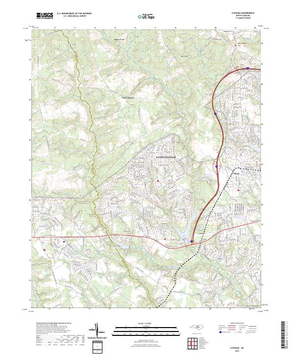
2022 Map of Clifdale
USGS Topo · Published 2022About this map
Fayetteville expands westward into the Atlantic Coastal Plain in this modern topographic survey, where residential growth meets the marshy drainages of Cumberland Co and Hoke Co. The landscape is defined by its water management and distinct ridge lines, including Mac Ridge and Caisson Hill to the north. Water features such as Lake Rim, Hutaff Lake, and Le Keith Lake are prominent, alongside smaller bodies like Lake William and Loraine Lake.
Find a feature on this map
235 named features on this map. Tap any name to fly to it.
Don’t see what you’re looking for? This feature index may not catch every label — zoom into the map to look around manually.
Map Details
Editions of this 2022 Clifdale Map
This is the sole edition of this map. No revisions or reprints were ever made.
Other maps of this area

1948 · Fayetteville
USGS Topo · 1:62,500

1948 · Clifdale
USGS Topo · 1:62,500

1948 · Nicholson Creek
USGS Topo · 1:24,000

1948 · Clifdale
USGS Topo · 1:24,000

1950 · Clifdale
USGS Topo · 1:24,000

1950 · Lobelia
USGS Topo · 1:24,000

1950 · Fayetteville
USGS Topo · 1:24,000

1950 · Manchester
USGS Topo · 1:24,000

1950 · Nicholson Creek
USGS Topo · 1:24,000

1951 · Clifdale
USGS Topo · 1:62,500
Featured Places
- Fayetteville, NC
- Fort Liberty, NC
- Hickory Grove, Fayetteville
- Cliffdale, Fayetteville
- Loch Lommond, Fayetteville