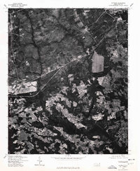
1976 Map of Clifdale
USGS Topo · Published 1978About this map
Clifdale and the surrounding Cumberland County landscape are shown in this 1976 orthophotomap, which utilizes aerial photography to provide a clear view of land use and development during the mid-1970s. The imagery reveals a complex pattern of cleared agricultural fields interspersed with dense woodland, illustrating the rural character of the region before significant suburban expansion. Transport routes such as Route 401 cut across the terrain, serving as primary arteries connecting these small settlements. The elevation and topographic relief of the area are highlighted by features like Caisson Hill, providing a look at the natural geography that shaped local land ownership and road placement. This photographic record, produced in cooperation with the Soil Conservation Service, serves as an essential tool for understanding the environmental and agricultural state of the North Carolina interior during this period.
Find a feature on this map
3 named features on this map. Tap any name to fly to it.
Don’t see what you’re looking for? This feature index may not catch every label — zoom into the map to look around manually.
Map Details
Editions of this 1976 Clifdale Map
This is the sole edition of this map. No revisions or reprints were ever made.
Other maps of this area

1948 · Fayetteville
USGS Topo · 1:62,500

1948 · Clifdale
USGS Topo · 1:62,500

1948 · Nicholson Creek
USGS Topo · 1:24,000

1948 · Clifdale
USGS Topo · 1:24,000

1950 · Clifdale
USGS Topo · 1:24,000

1950 · Lobelia
USGS Topo · 1:24,000

1950 · Fayetteville
USGS Topo · 1:24,000

1950 · Manchester
USGS Topo · 1:24,000

1950 · Nicholson Creek
USGS Topo · 1:24,000

1951 · Clifdale
USGS Topo · 1:62,500
Featured Places
- Fayetteville, NC
- Loch Lommond, Fayetteville
- Cliffdale, Fayetteville
- Fort Liberty, NC
- Emerald Gardens, Fayetteville