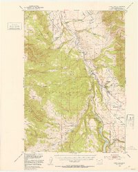
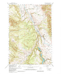
1950 Map of Cliff Lake
USGS Topo · Published 1953About this map
The Madison River valley and its dramatic lake system define this 1950s landscape, where ranching and early outdoor recreation began to intersect. This era shows a high concentration of established family holdings and seasonal camps, including the Wolf Creek Ranch, Sun Ranch, and Kirby Ranch. The emergence of tourism is evident through the presence of the Snowball Inn, Madison River Lodge, and Elliots Resort, catering to those drawn to the waters of Wade Lake and Cliff Lake.
Find a feature on this map
71 named features on this map. Tap any name to fly to it.
Don’t see what you’re looking for? This feature index may not catch every label — zoom into the map to look around manually.
Map Details
Editions of this 1950 Cliff Lake Map
6 editions found
Other maps of this area

1888 · Three Forks
USGS Topo · 1:250,000

1894 · Three Forks
USGS Topo · 1:250,000

1895 · Three Forks
USGS Topo · 1:250,000

1947 · Bozeman
USGS Topo · 1:250,000

1948 · Bozeman
USGS Topo · 1:250,000

1949 · Varney
USGS Topo · 1:62,500

1950 · Cliff Lake
USGS Topo · 1:62,500

1950 · Hebgen Dam
USGS Topo · 1:62,500

1950 · Cameron
USGS Topo · 1:62,500

1950 · Sphinx Mountain
USGS Topo · 1:62,500