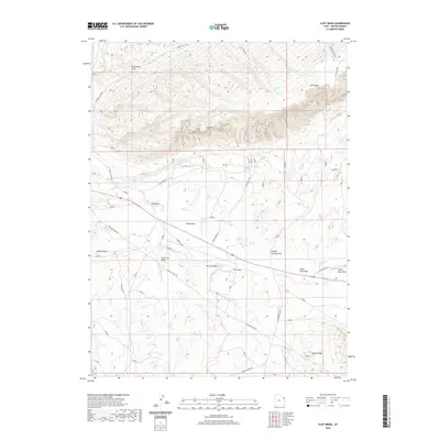
2020 Map of Cliff Ridge
USGS Topo · Published 2020About this map
Cliff Ridge dominates the northern reaches of this high-desert terrain in Uintah County, where vertical relief is defined by dramatic geological formations. The landscape is characterized by deep erosional features like Bourdette Draw and Kane Hollow, alongside prominent structural landmarks such as The Rim Rock and the sharp linear profile of Snake John Reef.
Find a feature on this map
23 named features on this map. Tap any name to fly to it.
Don’t see what you’re looking for? This feature index may not catch every label — zoom into the map to look around manually.
Map Details
Editions of this 2020 Cliff Ridge Map
This is the sole edition of this map. No revisions or reprints were ever made.
Other maps of this area

1885 · Ashley
USGS Topo · 1:250,000

1907 · Jensen
USGS Topo · 1:125,000

1910 · Jensen
USGS Topo · 1:125,000

1954 · Vernal
USGS Topo · 1:250,000

1955 · Stuntz Reservoir
USGS Topo · 1:24,000

1955 · Split Mountain
USGS Topo · 1:24,000

1958 · Vernal
USGS Topo · 1:250,000

1960 · Vernal
USGS Topo · 1:250,000
1965 · Dinosaur Quarry
USGS Topo · 1:24,000
1965 · Jensen
USGS Topo · 1:24,000