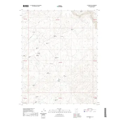
2021 Map of Cliff Rose Hill
USGS Topo · Published 2021About this map
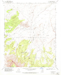
Cliff Rose Hill rises as the central landmark of this high-plateau landscape in Navajo County, where a complex network of seasonal washes and valleys defines the terrain. The geography is marked by descriptively named basins such as Potato Garden Valley, Resting Cattle Valley, and Squaw Dance Valley, suggesting traditional land uses and cultural significance. Water is a precious and scattered resource here, evidenced by Little Water, Cave Spring, and Gambler Lake. The presence of Main Rd and Indian Rte 8034 provides the primary infrastructure through these valleys, connecting remote points like Reed Valley and Crows Nest Valley. The map reveals a transition from the drainage of Mesa Trail Wash in the north down toward Forest Lake at the southern boundary, illustrating the vital role of specific water sources and named ridges in navigating this arid environment.
Find a feature on this map
36 named features on this map. Tap any name to fly to it.
Don’t see what you’re looking for? This feature index may not catch every label — zoom into the map to look around manually.
Map Details
Editions of this 2021 Cliff Rose Hill Map
This is the sole edition of this map. No revisions or reprints were ever made.
Other maps of this area

1883 · Marsh Pass
USGS Topo · 1:250,000

1892 · Marsh Pass
USGS Topo · 1:250,000

1956 · Marble Canyon
USGS Topo · 1:250,000

1959 · Marble Canyon
USGS Topo · 1:250,000

1961 · Marble Canyon
USGS Topo · 1:250,000
1968 · Toh Ne Zhonnie Spring
USGS Topo · 1:24,000
1968 · Hole In Rock Valley
USGS Topo · 1:24,000
1968 · Owl Spring
USGS Topo · 1:24,000

1968 · Yucca Hill
USGS Topo · 1:24,000
1968 · Chilchinbito
USGS Topo · 1:24,000