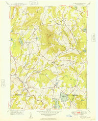
1949 Map of Clifford
USGS Topo · Published 1949About this map
Elk Hill dominates the center of this 1940s landscape, rising with two prominent summits known as North Knob and South Knob. This topography dictates the settlement patterns of eastern Susquehanna County, where roads and small villages like Clifford and Dundaff follow the lowlands carved by Tunkhannock Creek and its many branches. The area shows a transition from traditional rural life to seasonal recreation, evidenced by the Elkview Country Club situated between Crystal Lake and Newton Lake near the southern border.
Find a feature on this map
43 named features on this map. Tap any name to fly to it.
Don’t see what you’re looking for? This feature index may not catch every label — zoom into the map to look around manually.
Map Details
Editions of this 1949 Clifford Map
2 editions found
Other maps of this area

1892 · Honesdale
USGS Topo · 1:62,500

1892 · Dundaff
USGS Topo · 1:62,500

1926 · Starrucca
USGS Topo · 1:62,500

1930 · Starrucca
USGS Topo · 1:48,000

1932 · Susquehanna
USGS Topo · 1:62,500

1933 · Starrucca
USGS Topo · 1:62,500

1935 · Susquehanna
USGS Topo · 1:62,500

1943 · Honesdale
USGS Topo · 1:125,000

1946 · Dalton
USGS Topo · 1:24,000

1946 · Forest City
USGS Topo · 1:24,000