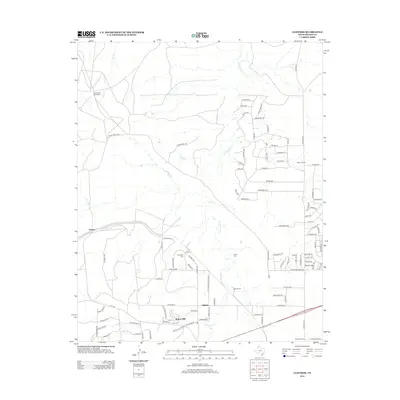
2012 Map of Cliffside
USGS Topo · Published 2012About this map
The high plains landscape of Potter County northwest of Amarillo is defined by the carved drainage of W Amarillo Cr and the specialized industry of the Cliffside Gas Field Camp. This 2012 survey shows a unique mix of traditional ranching heritage and modern residential development. Established landmarks like the Wilkins Ranch and Diaz Ranch sit alongside newer communities such as Bishop Hills. The map serves as a vital record for genealogists, identifying localized burials at Townsend Cem and Arnot Cem. The presence of the McCollum Dairy and Wesley Dairy reflects the area's agricultural continuity, while terrain features like Hedge Coke Pass and Coyote Blf illustrate the breaks in the Panhandle's level horizon. The rail-linked settlement at Gentry further anchors the historical transport network of the region.
Find a feature on this map
99 named features on this map. Tap any name to fly to it.
Don’t see what you’re looking for? This feature index may not catch every label — zoom into the map to look around manually.
Map Details
Editions of this 2012 Cliffside Map
This is the sole edition of this map. No revisions or reprints were ever made.
Other maps of this area

1934 · Ady
USGS Topo · 1:62,500

1934 · Cliffside
USGS Topo · 1:62,500

1936 · Cliffside
USGS Topo · 1:62,500

1936 · Ady
USGS Topo · 1:62,500

1953 · Chunky
USGS Topo · 1:24,000

1953 · Puente
USGS Topo · 1:24,000

1953 · Pleasant Valley
USGS Topo · 1:24,000

1953 · Cliffside
USGS Topo · 1:24,000

1954 · Tucumcari
USGS Topo · 1:250,000

1954 · Amarillo
USGS Topo · 1:250,000