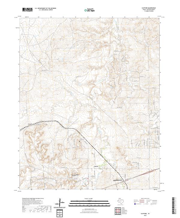
2022 Map of Cliffside
USGS Topo · Published 2022About this map
West Amarillo Creek and its tributary W Amarillo Cr carve a network of drainages across this Potter County landscape, where the High Plains break into the Canadian River breaks. The settlement of Cliffside and the residential area of Bishop Hills anchor the southern portion of the map, illustrating the suburban expansion northwest of Amarillo. For those researching local family history, the Townsend Cem is a significant genealogical landmark located north of Cliffside. The terrain is marked by notable high points such as Hedge Coke Pass and Patrick Pass, which influence the local road network including Brickplant Rd and Rim Ranch Rd. To the northwest, the small community of Gentry sits near Horse Cr, reflecting the more dispersed rural character that persists away from the growing urban fringe.
Find a feature on this map
79 named features on this map. Tap any name to fly to it.
Don’t see what you’re looking for? This feature index may not catch every label — zoom into the map to look around manually.
Map Details
Editions of this 2022 Cliffside Map
This is the sole edition of this map. No revisions or reprints were ever made.
Other maps of this area

1934 · Ady
USGS Topo · 1:62,500

1934 · Cliffside
USGS Topo · 1:62,500

1936 · Cliffside
USGS Topo · 1:62,500

1936 · Ady
USGS Topo · 1:62,500

1953 · Chunky
USGS Topo · 1:24,000

1953 · Puente
USGS Topo · 1:24,000

1953 · Pleasant Valley
USGS Topo · 1:24,000

1953 · Cliffside
USGS Topo · 1:24,000

1954 · Tucumcari
USGS Topo · 1:250,000

1954 · Amarillo
USGS Topo · 1:250,000