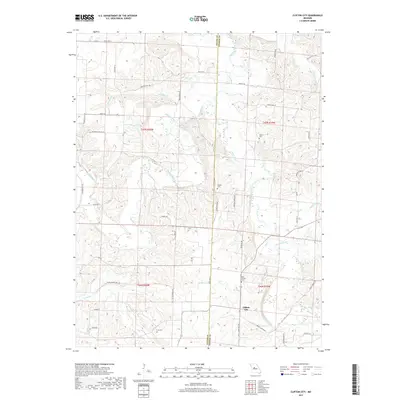
2017 Map of Clifton City
USGS Topo · Published 2017About this map
The Lamine River and Muddy Creek wind through the borderlands of Cooper and Pettis counties, where the settlement of Clifton City serves as a local anchor. This modern survey reveals a landscape deeply connected to its rural roots and genealogy, evidenced by a high density of family and community burial grounds including Sowers Cem, Lamine Cem, Irwin Cem, and Saint Josephs Cem. The topographical detail traces the elevation changes around Fortunes Lake and along various tributaries like Landon Br and Johnson Br. Local navigation relies on a network of descriptively named routes, such as Bugger Town Rd, Swinging Bridge Dr, and Bluebird Hollow Rd, which reflect the area's geographic character and social history. The map also identifies section lines and townships, essential for property research and tracing land use patterns in this part of central Missouri.
Find a feature on this map
47 named features on this map. Tap any name to fly to it.
Don’t see what you’re looking for? This feature index may not catch every label — zoom into the map to look around manually.
Map Details
Editions of this 2017 Clifton City Map
This is the sole edition of this map. No revisions or reprints were ever made.
Other maps of this area

1887 · Sedalia
USGS Topo · 1:125,000

1888 · Boonville
USGS Topo · 1:125,000

1894 · Sedalia
USGS Topo · 1:125,000

1944 · Sedalia East
USGS Topo · 1:24,000

1946 · Sedalia East
USGS Topo · 1:24,000

1947 · Jefferson City
USGS Topo · 1:250,000

1953 · Pilot Grove North
USGS Topo · 1:24,000

1953 · Pilot Grove South
USGS Topo · 1:24,000
1953 · Otterville East
USGS Topo · 1:24,000
1953 · Nelson
USGS Topo · 1:24,000