
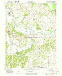
1953 Map of Pilot Grove North
USGS Topo · Published 1954About this map
The confluence of the Blackwater River and Lamine River dominates this mid-century portrait of Cooper County, Missouri. The settlement of Blackwater sits along the Missouri Pacific railroad line, while Chouteau Springs serves as a local landmark further east. The landscape is a network of river bottomlands and high bluffs, such as Roberts Bluff, connected by a series of crossings including Blackwater Bridge, Dicks Bridge, and Bryant Bottom Bridge.
Find a feature on this map
34 named features on this map. Tap any name to fly to it.
Don’t see what you’re looking for? This feature index may not catch every label — zoom into the map to look around manually.
Map Details
Editions of this 1953 Pilot Grove North Map
2 editions found
Other maps of this area

1887 · Sedalia
USGS Topo · 1:125,000

1888 · Boonville
USGS Topo · 1:125,000

1890 · Glasgow
USGS Topo · 1:125,000

1890 · Marshall
USGS Topo · 1:125,000

1892 · Marshall
USGS Topo · 1:125,000

1894 · Sedalia
USGS Topo · 1:125,000

1901 · Marshall
USGS Topo · 1:125,000

1940 · Marshall
USGS Topo · 1:62,500

1944 · Marshall
USGS Topo · 1:62,500

1947 · Glasgow
USGS Topo · 1:62,500