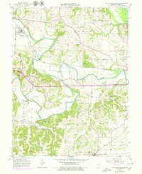
1953 Map of Pilot Grove North
USGS Topo · Published 1979About this map
Blackwater River and the Lamine River converge in this mid-century landscape of Cooper County, where the infrastructure of the Missouri Pacific and Kansas Texas Missouri railroads dictated the growth of local commerce. The map records a transition from the bottomlands of Slaughterhouse Bend to the higher ground of Pilot Grove. Rural life is meticulously documented through local institutions like Locust Grove Sch, Lamine Ch, and the community gathering point at Chouteau Springs. Engineering of the era is visible in the channelization of the Lamine Ditch and the placement of crossings such as Dicks Bridge and Bryant Bottom Bridge. Genealogists will find value in the specific locations of several burial grounds, including Herndon Cem and St Martin Cem, which sit near the winding course of Chouteau Creek.
Find a feature on this map
33 named features on this map. Tap any name to fly to it.
Don’t see what you’re looking for? This feature index may not catch every label — zoom into the map to look around manually.
Map Details
Editions of this 1953 Pilot Grove North Map
2 editions found

Other maps of this area

1887 · Sedalia
USGS Topo · 1:125,000

1888 · Boonville
USGS Topo · 1:125,000

1890 · Glasgow
USGS Topo · 1:125,000

1890 · Marshall
USGS Topo · 1:125,000

1892 · Marshall
USGS Topo · 1:125,000

1894 · Sedalia
USGS Topo · 1:125,000

1901 · Marshall
USGS Topo · 1:125,000

1940 · Marshall
USGS Topo · 1:62,500

1944 · Marshall
USGS Topo · 1:62,500

1947 · Glasgow
USGS Topo · 1:62,500