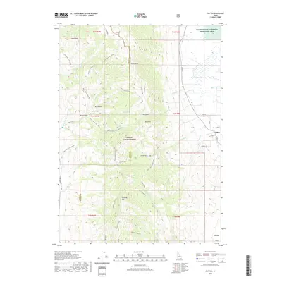
2020 Map of Clifton
USGS Topo · Published 2020About this map
Clifton and Dayton sit at the eastern base of a prominent mountain range that transitions into the wetlands of the Bear River valley. This landscape is defined by the sharp vertical rise of Oxford Ridge and S Oxford Peak, which are part of the Caribou National Forest. The mountain front is dissected by numerous drainages and canyons, including Mine Hollow, Steep Canyon, and Ruben Hollow. These peaks look down upon the Oxford Slough Waterfowl Production Area, a significant marsh environment centered around Oxford Slough. A complex network of trails and roads, such as Clifton Basin To Weston Peak and the Old Baldy Connector, provides access into high-elevation basins like Clifton Basin and Davis Basin. The proximity of these agricultural settlements to the specialized waterfowl habitat highlights the area's dual character as both a working rural landscape and a protected natural corridor.
Find a feature on this map
57 named features on this map. Tap any name to fly to it.
Don’t see what you’re looking for? This feature index may not catch every label — zoom into the map to look around manually.
Map Details
Editions of this 2020 Clifton Map
This is the sole edition of this map. No revisions or reprints were ever made.
Other maps of this area

1915 · Preston
USGS Topo · 1:96,000

1918 · Preston
USGS Topo · 1:125,000

1954 · Pocatello
USGS Topo · 1:250,000

1955 · Preston
USGS Topo · 1:250,000

1958 · Pocatello
USGS Topo · 1:250,000

1958 · Preston
USGS Topo · 1:250,000

1962 · Preston
USGS Topo · 1:250,000

1968 · Malad Summit
USGS Topo · 1:24,000

1968 · Oxford
USGS Topo · 1:24,000

1968 · Malad City East
USGS Topo · 1:24,000