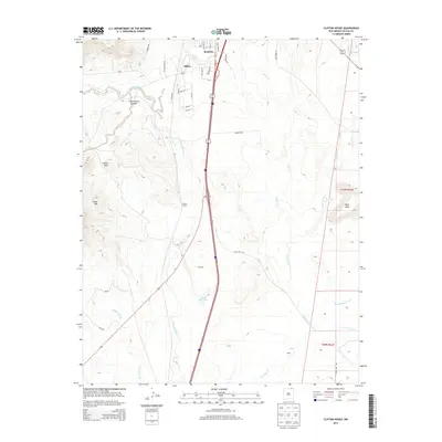
2013 Map of Clifton House
USGS Topo · Published 2013About this map
Raton and its southern neighboring settlements are anchored by the north-south transport corridor that follows the historic paths of the Canadian River and its tributaries. This 2013 survey captures the landscape as it transitions from the industrial mining-related street names in Dillon—such as Ore Ave and Gold St—to the expansive ranching and irrigation terrain further south. The map illustrates a complex drainage system where Raton Creek and Chicorica Creek meander through the high plains toward the Davis Reservoir. To the west, the prominent topography of Green Mountain and the Clifton Hills provides a stark contrast to the flatter mesa lands like Black Mesa to the east. This area remains a vital junction for New Mexico, preserving the names of early waypoints like Clifton House and Stockton along the river's path.
Find a feature on this map
36 named features on this map. Tap any name to fly to it.
Don’t see what you’re looking for? This feature index may not catch every label — zoom into the map to look around manually.
Map Details
Editions of this 2013 Clifton House Map
This is the sole edition of this map. No revisions or reprints were ever made.
Other maps of this area

1912 · Raton
USGS Topo · 1:62,500

1914 · Raton
USGS Topo · 1:62,500

1915 · Brilliant
USGS Topo · 1:62,500

1915 · Koehler
USGS Topo · 1:62,500

1917 · Koehler
USGS Topo · 1:62,500

1954 · Raton
USGS Topo · 1:250,000

1958 · Raton
USGS Topo · 1:250,000

1971 · Clifton House
USGS Topo · 1:24,000
1971 · Raton
USGS Topo · 1:24,000
1971 · Red River Peak
USGS Topo · 1:24,000