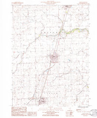
1986 Map of Clifton
USGS Topo · Published 1986About this map
Clifton and Ashkum are the primary settlements in this Iroquois County landscape, positioned along the central transportation corridor. The terrain is characterized by the meandering path of Langan Creek and its southern counterpart, Prairie Creek. The map shows a transition from rural agricultural land to organized village grids, notably including a Landing Strip and a Radio Tower near the village of Clifton. Local genealogists and researchers can identify specific land use through labels such as the Cem located near the town centers and the Sub Sta that indicates the infrastructure developments of the late 20th century. The inclusion of the Sewage Disposal Pond reflects the mid-1980s municipal planning of these Iroquois County communities.
Find a feature on this map
13 named features on this map. Tap any name to fly to it.
Don’t see what you’re looking for? This feature index may not catch every label — zoom into the map to look around manually.
Map Details
Editions of this 1986 Clifton Map
This is the sole edition of this map. No revisions or reprints were ever made.
Other maps of this area

1922 · Kankakee
USGS Topo · 1:62,500

1923 · Herscher
USGS Topo · 1:62,500

1924 · Kankakee
USGS Topo · 1:62,500

1925 · Herscher
USGS Topo · 1:62,500

1944 · Piper City
USGS Topo · 1:48,000

1944 · Gilman
USGS Topo · 1:62,500

1946 · Gilman
USGS Topo · 1:62,500

1947 · Piper City
USGS Topo · 1:62,500

1953 · Chicago
USGS Topo · 1:250,000

1953 · Danville
USGS Topo · 1:250,000