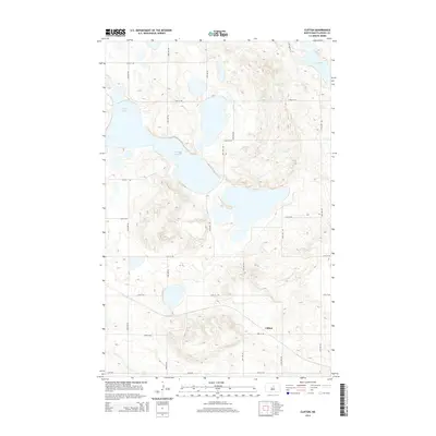
2014 Map of Clifton
USGS Topo · Published 2014About this map
Clifton serves as the primary landmark in this section of the Pierce County prairie, positioned along 33rd St NE in a landscape defined by glacial depressions and intermittent water. The topography is dominated by the sprawling Antelope Lakes complex, which stretches across the central and northern portions of the quadrangle. These water bodies, along with Lesmeister Lake in the northeast corner, dictate the local road geometry, forcing the section-line grid of routes like 24th Ave NE and 37th St NE to skirt the edges of the basins. This survey captures the rural character of central North Dakota, where the agricultural grid is interrupted only by these significant natural basins and the modest footprint of the Clifton settlement.
Find a feature on this map
19 named features on this map. Tap any name to fly to it.
Don’t see what you’re looking for? This feature index may not catch every label — zoom into the map to look around manually.
Map Details
Editions of this 2014 Clifton Map
This is the sole edition of this map. No revisions or reprints were ever made.
Other maps of this area

1940 · Aylmer
USGS Topo · 1:62,500

1941 · Selz
USGS Topo · 1:62,500
1951 · Harvey
USGS Topo · 1:24,000

1951 · Martin
USGS Topo · 1:24,000

1951 · Anamoose SW
USGS Topo · 1:24,000

1951 · Selz NW
USGS Topo · 1:24,000

1952 · New Rockford
USGS Topo · 1:250,000

1953 · Devils Lake
USGS Topo · 1:250,000

1954 · Minot
USGS Topo · 1:250,000

1954 · McClusky
USGS Topo · 1:250,000