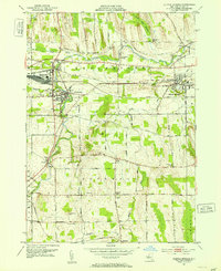
1951 Map of Clifton Springs
USGS Topo · Published 1953About this map
Canandaigua Outlet winds through the heart of this mid-century landscape, serving as a focal point for the interconnected industrial and agricultural hubs of Manchester, Shortsville, and Clifton Springs. The map reveals a high density of rural cemeteries and institutions, including the County Home and its associated County Home Cemetery, alongside local landmarks like Cumorah Hill and the Bunker Hill Swamp.
Find a feature on this map
53 named features on this map. Tap any name to fly to it.
Don’t see what you’re looking for? This feature index may not catch every label — zoom into the map to look around manually.
Map Details
Editions of this 1951 Clifton Springs Map
3 editions found
Other maps of this area

1899 · Palmyra
USGS Topo · 1:62,500

1900 · Macedon
USGS Topo · 1:62,500

1900 · Canandaigua
USGS Topo · 1:62,500

1902 · Phelps
USGS Topo · 1:62,500

1902 · Palmyra
USGS Topo · 1:62,500

1903 · Canandaigua
USGS Topo · 1:62,500

1942 · Canandaigua
USGS Topo · 1:31,680
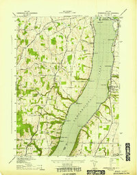
1942 · Canandaigua Lake
USGS Topo · 1:31,680

1942 · Rushville
USGS Topo · 1:31,680

1942 · Stanley
USGS Topo · 1:31,680