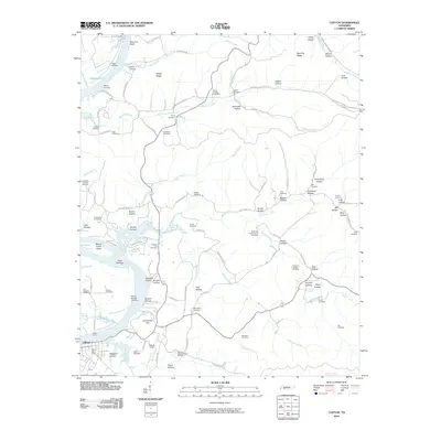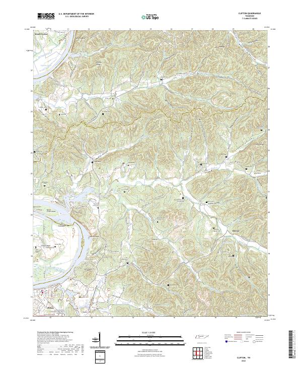
2022 Map of Clifton
USGS Topo · Published 2022About this map
Clifton serves as a primary riverfront hub on this survey of the Tennessee River and its intricate network of surrounding hills and hollows. The map reveals a landscape deeply connected to the river, featuring Glenkirk Island, Beech Creek Island, and several sloughs like Bateman Slough and Penny Slough. High ground such as Carrollville Hill and New Era Bluff defines the terrain, while the interior is densely packed with family names and small burial sites. Genealogists will find significant value in the documentation of secluded sites like the Henry Culp Family Plot, Flippo Grave, and the Methodist Camp Ground Cem. The transition from the riverbanks to the ridges of Kittrell Ridge and Crossno Ridge illustrates a classic Tennessee river-valley settlement pattern, where roads like Clifton Rd wind through numerous named hollows including Mooney and Culp Hollow.
Find a feature on this map
157 named features on this map. Tap any name to fly to it.
Don’t see what you’re looking for? This feature index may not catch every label — zoom into the map to look around manually.
Map Details
Editions of this 2022 Clifton Map
This is the sole edition of this map. No revisions or reprints were ever made.
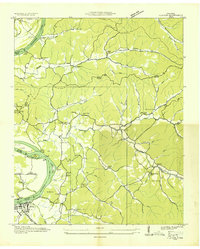
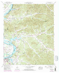
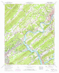
Historical Maps of Clifton Through Time
8 maps found