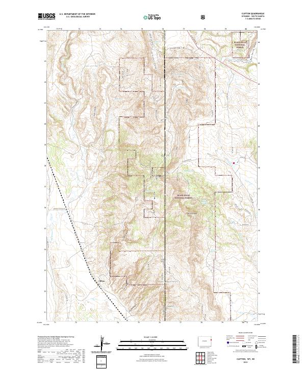
2021 Map of Clifton
USGS Topo · Published 2021About this map
The Clifton settlement sits near the southwestern edge of this landscape, positioned where Line Cr meets the drainage coming from Kouba Canyon. This area marks a significant geographical boundary as the state line between Wyoming and South Dakota cuts vertically through the terrain, also separating Weston and Custer Counties. Much of the eastern and northern portions of the quadrangle are protected lands within the Black Hills National Forest, characterized by numerous spring-fed canyons and elevated features like Wildcat Peak.
Find a feature on this map
47 named features on this map. Tap any name to fly to it.
Don’t see what you’re looking for? This feature index may not catch every label — zoom into the map to look around manually.
Map Details
Editions of this 2021 Clifton Map
This is the sole edition of this map. No revisions or reprints were ever made.
Other maps of this area

1896 · Harney Peak
USGS Topo · 1:125,000

1899 · Newcastle
USGS Topo · 1:125,000

1901 · Harney Peak
USGS Topo · 1:125,000

1901 · Newcastle
USGS Topo · 1:125,000

1951 · Owens
USGS Topo · 1:24,000

1951 · Dewey
USGS Topo · 1:24,000

1951 · Dewey SW
USGS Topo · 1:24,000

1951 · Newcastle
USGS Topo · 1:24,000

1951 · Fanny Peak
USGS Topo · 1:24,000

1951 · Clifton
USGS Topo · 1:24,000