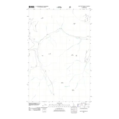
2011 Map of Clifty Mountain
USGS Topo · Published 2011About this map
Clifty Mountain and the surrounding peaks of Bonner County define this northern Idaho landscape, characterized by a complex network of high ridges and drainage basins. The area’s industrial history is anchored by the Boulder Mine, situated on the western slopes of Iron Mountain. This site overlooks the headwaters of Boulder Creek, which serves as a central hydrological axis for the quadrangle, joined by numerous tributaries with evocative local names such as Found Girl Creek, Hunt Girl Creek, and Rummy Creek.
Find a feature on this map
25 named features on this map. Tap any name to fly to it.
Don’t see what you’re looking for? This feature index may not catch every label — zoom into the map to look around manually.
Map Details
Editions of this 2011 Clifty Mountain Map
This is the sole edition of this map. No revisions or reprints were ever made.
Other maps of this area

1911 · Priest Lake
USGS Topo · 1:250,000

1913 · Priest Lake
USGS Topo · 1:250,000

1951 · Mt Pend Oreille
USGS Topo · 1:62,500

1951 · Elmira
USGS Topo · 1:62,500

1958 · Sandpoint
USGS Topo · 1:250,000

1963 · Sandpoint
USGS Topo · 1:250,000
1965 · Curley Creek
USGS Topo · 1:24,000
1965 · Leonia
USGS Topo · 1:24,000

1965 · Twentymile Creek
USGS Topo · 1:24,000
1965 · Moyie Springs
USGS Topo · 1:24,000