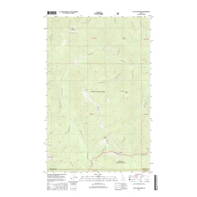
2017 Map of Clifty Mountain
USGS Topo · Published 2017About this map
Orville Heath sits at the southwestern edge of this landscape where the high peaks of the Selkirk Mountains descend toward the Boundary and Bonner County line. The terrain is dominated by steep ridges and deep drainages, including Clifty Mountain and Iron Mtn, within the expansive reaches of the Kaniksu National Forest. A complex network of watercourses, such as Found Girl Cr and Hunt Girl Cr, carve through the timbered slopes, reflecting the area's hydrology before modern forest management altered these corridors.
Find a feature on this map
50 named features on this map. Tap any name to fly to it.
Don’t see what you’re looking for? This feature index may not catch every label — zoom into the map to look around manually.
Map Details
Editions of this 2017 Clifty Mountain Map
This is the sole edition of this map. No revisions or reprints were ever made.
Other maps of this area

1911 · Priest Lake
USGS Topo · 1:250,000

1913 · Priest Lake
USGS Topo · 1:250,000

1951 · Mt Pend Oreille
USGS Topo · 1:62,500

1951 · Elmira
USGS Topo · 1:62,500

1958 · Sandpoint
USGS Topo · 1:250,000

1963 · Sandpoint
USGS Topo · 1:250,000
1965 · Curley Creek
USGS Topo · 1:24,000
1965 · Leonia
USGS Topo · 1:24,000

1965 · Twentymile Creek
USGS Topo · 1:24,000
1965 · Moyie Springs
USGS Topo · 1:24,000