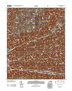
2011 Map of Clinchport
USGS Topo · Published 2011About this map
The Clinch River carves a deep path through this portion of Scott County, shaping a landscape defined by sharp ridges and significant transportation engineering. Central to this topography is the Natural Tunnel, a massive geological feature used by the railroad to pierce through Cove Ridge. The mapping details a complex network of industrial and agricultural sites, from the operations at Daniboone Yard near the southern border to several historic milling locations such as Rhoton Mill and Craft Mill along Mill Creek.
Find a feature on this map
83 named features on this map. Tap any name to fly to it.
Don’t see what you’re looking for? This feature index may not catch every label — zoom into the map to look around manually.
Map Details
Editions of this 2011 Clinchport Map
This is the sole edition of this map. No revisions or reprints were ever made.
Other maps of this area

1894 · Estillville
USGS Topo · 1:125,000

1920 · Wise
USGS Topo · 1:48,000

1921 · Big Stone Gap
USGS Topo · 1:48,000

1921 · Wise
USGS Topo · 1:62,500

1922 · Big Stone Gap
USGS Topo · 1:62,500

1929 · Big Stone Gap
USGS Topo · 1:62,500

1935 · Moggasin
USGS Topo · 1:48,000

1935 · East Stone Gap
USGS Topo · 1:24,000

1935 · Kingsport
USGS Topo · 1:24,000

1935 · Clinchport
USGS Topo · 1:24,000