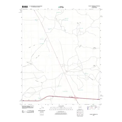
2010 Map of Clines Corners
USGS Topo · Published 2010About this map
Clines Corners serves as the primary junction in this high-desert landscape, where the convergence of major travel routes meets a network of scattered ranching outposts. The map reveals a settlement pattern deeply tied to water management, evidenced by the numerous catchment points such as Ricardo Tank, West Pasture Tank, and Albino Tank. These vital resources support established family holdings like Tapia Ranch, Los Norios Ranch, and the Hagerman Ranch.
Find a feature on this map
31 named features on this map. Tap any name to fly to it.
Don’t see what you’re looking for? This feature index may not catch every label — zoom into the map to look around manually.
Map Details
Editions of this 2010 Clines Corners Map
This is the sole edition of this map. No revisions or reprints were ever made.
Other maps of this area

1894 · Lamy
USGS Topo · 1:125,000

1954 · Santa Fe
USGS Topo · 1:250,000

1954 · Fort Sumner
USGS Topo · 1:250,000

1958 · Fort Sumner
USGS Topo · 1:250,000

1958 · Santa Fe
USGS Topo · 1:250,000

1960 · Lobo Hill
USGS Topo · 1:62,500

1960 · Stanley
USGS Topo · 1:62,500
1966 · El Cabo
USGS Topo · 1:24,000
1966 · Mesa El Toro
USGS Topo · 1:24,000
1966 · Clines Corners
USGS Topo · 1:24,000