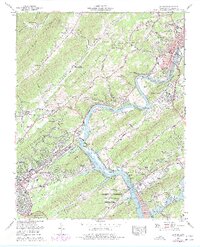
1968 Map of Clinton
USGS Topo · Published 1977About this map
The U S Atomic Energy Commission (Oak Ridge Area) dominates the southern landscape of this mid-century survey, reflecting the Cold War-era expansion of nuclear research and energy production. The industrial character of the region is further anchored by the massive Bull Run Steam Plant situated near Edgemoor. To the north, the county seat of Clinton serves as a hub of activity where the Southern Railway meets the Clinch River, showing the transition from traditional river-and-rail commerce to modern infrastructure like the Melton Hill Lake reservoir.
Find a feature on this map
101 named features on this map. Tap any name to fly to it.
Don’t see what you’re looking for? This feature index may not catch every label — zoom into the map to look around manually.
Map Details
Editions of this 1968 Clinton Map
3 editions found
Other maps of this area

1893 · Briceville
USGS Topo · 1:125,000

1895 · Loudon
USGS Topo · 1:125,000

1895 · Briceville
USGS Topo · 1:125,000

1896 · Briceville
USGS Topo · 1:125,000

1935 · Bethel Valley
USGS Topo · 1:24,000

1935 · Bearden
USGS Topo · 1:24,000

1935 · Lovell
USGS Topo · 1:24,000

1936 · Duncan Flats
USGS Topo · 1:24,000

1936 · Windrock
USGS Topo · 1:24,000

1936 · Norris Dam
USGS Topo · 1:48,000
Featured Places
- Oak Ridge, TN
- Clinton, TN
- Jackson Square, Oak Ridge
- Conasauga Heights, Oak Ridge
- Emory Heights, Oak Ridge