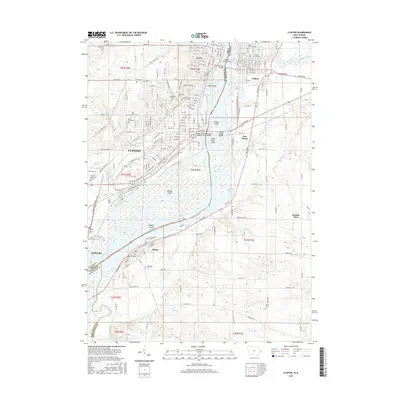
2015 Map of Clinton
USGS Topo · Published 2015About this map
The Mississippi River carves a complex course through this border region, defining the landscape between Clinton, Iowa, and Fulton, Illinois. A dense network of industrial and residential streets marks the city center of Clinton, where transportation infrastructure like the Chicago and Northwestern Railroad Swing Bridge and the Clinton Illinois Bridge connect the two states. The river itself is fragmented by large landforms such as Beaver Island, Albany Island, and Willow Island, creating distinct channels including Beaver Slough and Joyces Slough.
Find a feature on this map
78 named features on this map. Tap any name to fly to it.
Don’t see what you’re looking for? This feature index may not catch every label — zoom into the map to look around manually.
Map Details
Editions of this 2015 Clinton Map
This is the sole edition of this map. No revisions or reprints were ever made.
Other maps of this area

1891 · Clinton
USGS Topo · 1:62,500

1892 · Goose Lake
USGS Topo · 1:62,500

1892 · Leclaire
USGS Topo · 1:62,500

1893 · Leclaire
USGS Topo · 1:62,500

1894 · Goose Lake
USGS Topo · 1:62,500

1894 · Clinton
USGS Topo · 1:62,500

1899 · Clinton
USGS Topo · 1:125,000

1952 · Erie
USGS Topo · 1:62,500

1952 · Clinton
USGS Topo · 1:62,500
1952 · Cordova
USGS Topo · 1:24,000