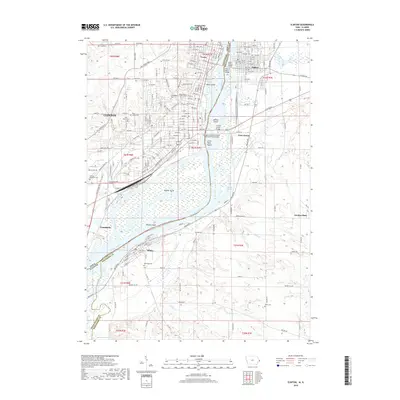
2018 Map of Clinton
USGS Topo · Published 2018About this map
The Mississippi River serves as the central artery and state boundary for this region, dividing Clinton, Iowa, from the Illinois settlements of Fulton and Albany. This 2018 survey reveals a landscape defined by industrial river crossings and a high density of established cemeteries, reflecting the deep-rooted nature of these riverfront communities. The city of Clinton and its northern neighborhood of Lyons are connected to the eastern shore via structures like the Mark N Morris Bridge and the Chicago and Northwestern Railroad Swing Bridge. Within the river's channel, large landmasses such as Beaver Island and Little Rock Island create a complex network of side channels, including Beaver Slough. Further south, the map details the rural character of Whiteside County and Rock Island County, where the Meredosia Slough and Spring Cr drain into the main river valley near the town of Albany.
Find a feature on this map
130 named features on this map. Tap any name to fly to it.
Don’t see what you’re looking for? This feature index may not catch every label — zoom into the map to look around manually.
Map Details
Editions of this 2018 Clinton Map
This is the sole edition of this map. No revisions or reprints were ever made.
Other maps of this area

1891 · Clinton
USGS Topo · 1:62,500

1892 · Goose Lake
USGS Topo · 1:62,500

1892 · Leclaire
USGS Topo · 1:62,500

1893 · Leclaire
USGS Topo · 1:62,500

1894 · Goose Lake
USGS Topo · 1:62,500

1894 · Clinton
USGS Topo · 1:62,500

1899 · Clinton
USGS Topo · 1:125,000

1952 · Erie
USGS Topo · 1:62,500

1952 · Clinton
USGS Topo · 1:62,500
1952 · Cordova
USGS Topo · 1:24,000