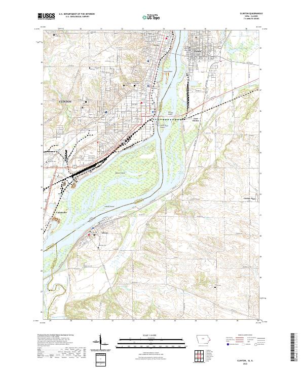
2022 Map of Clinton
USGS Topo · Published 2022About this map
The Mississippi River serves as the central artery for this riverfront region, dividing the communities of Clinton and Camanche in Iowa from Fulton, East Clinton, and Albany in Illinois. This riverine landscape is defined by a complex network of secondary channels and islands, including Beaver Island and Joyce Island, alongside significant wetlands such as Cattail Slough and Meredosia Slough. The industrial and civic development of the area is anchored by the Clinton County Courthouse and Clinton Community College, while the Union Pacific Railroad corridor underscores the city's enduring role as a transportation hub. Local history and genealogy are well-represented by numerous burial grounds, from the large Springdale Cem and Clinton Memorial Cem to smaller rural sites like Lusk Cem and Minta Cem. The presence of Harts Mill Rd and various trails like the Discovery Trail provide evidence of both historical industry and modern recreational land use.
Find a feature on this map
87 named features on this map. Tap any name to fly to it.
Don’t see what you’re looking for? This feature index may not catch every label — zoom into the map to look around manually.
Map Details
Editions of this 2022 Clinton Map
This is the sole edition of this map. No revisions or reprints were ever made.
Other maps of this area

1891 · Clinton
USGS Topo · 1:62,500

1892 · Goose Lake
USGS Topo · 1:62,500

1892 · Leclaire
USGS Topo · 1:62,500

1893 · Leclaire
USGS Topo · 1:62,500

1894 · Goose Lake
USGS Topo · 1:62,500

1894 · Clinton
USGS Topo · 1:62,500

1899 · Clinton
USGS Topo · 1:125,000

1952 · Erie
USGS Topo · 1:62,500

1952 · Clinton
USGS Topo · 1:62,500
1952 · Cordova
USGS Topo · 1:24,000