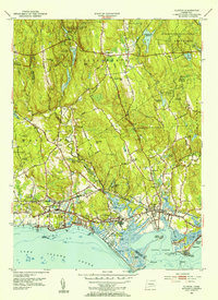
1951 Map of Clinton
USGS Topo · Published 1953About this map
Clinton and Madison line the shoreline of Long Island Sound in this early 1950s study, where the coastal lowlands meet the rising timberlands of the Cockaponset State Forest. The map documents a transition from the dense beach developments of Clinton Beach and Ridgewood to the interior highlands marked by Roast Meat Hill and Chestnut Hill. Historic transportation corridors like the Boston Post Road and the Hartford and New Haven Turnpike illustrate the region's enduring role as a maritime and transit hub. Local landmarks provide significant genealogical and community context, including the Red Sch at Cow Hill and several burial grounds such as Evergreen Cem and St Marys Cem. The hydrology is defined by the winding Hammonasset River and numerous ponds like Schreeder Pond in Chatfield Hollow State Park, reflecting the area's development around its water resources.
Find a feature on this map
61 named features on this map. Tap any name to fly to it.
Don’t see what you’re looking for? This feature index may not catch every label — zoom into the map to look around manually.
Map Details
Editions of this 1951 Clinton Map
3 editions found
Other maps of this area

1893 · Guilford
USGS Topo · 1:62,500

1893 · Saybrook
USGS Topo · 1:62,500

1943 · Durham
USGS Topo · 1:25,000

1944 · Essex
USGS Topo · 1:31,680

1944 · Deep River
USGS Topo · 1:31,680

1947 · Hartford
USGS Topo · 1:250,000

1948 · Hartford
USGS Topo · 1:250,000

1951 · Clinton
USGS Topo · 1:31,680
1952 · Deep River
USGS Topo · 1:31,680

1952 · Haddam
USGS Topo · 1:31,680