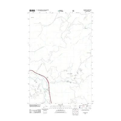
2011 Map of Clinton
USGS Topo · Published 2011About this map
Clinton serves as the focal point for this Missoula County quadrangle, situated where the Clark Fork river meets the mouth of Wallace Creek. The landscape is heavily marked by a legacy of resource extraction, with a dense concentration of mining claims lining the drainages south of Potomac RD. These include the Triangle Mine Martha Mine, the Cape Nome Mine, and the Hidden Treasure Mine.
Find a feature on this map
42 named features on this map. Tap any name to fly to it.
Don’t see what you’re looking for? This feature index may not catch every label — zoom into the map to look around manually.
Map Details
Editions of this 2011 Clinton Map
This is the sole edition of this map. No revisions or reprints were ever made.
Other maps of this area

1903 · Bonner
USGS Topo · 1:125,000

1947 · Butte
USGS Topo · 1:250,000

1958 · Butte
USGS Topo · 1:250,000

1959 · Cleveland Mountain
USGS Topo · 1:62,500

1959 · Ravenna
USGS Topo · 1:62,500

1960 · Butte
USGS Topo · 1:250,000

1962 · Butte
USGS Topo · 1:250,000
1965 · Sunflower Mountain
USGS Topo · 1:24,000
1965 · Clinton
USGS Topo · 1:24,000
1965 · Blue Point
USGS Topo · 1:24,000