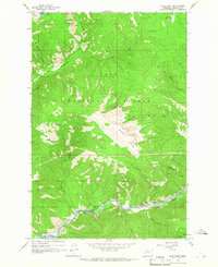
1965 Map of Blue Point
USGS Topo · Published 1967About this map
The Blackfoot River carves through the southern edge of this landscape, flanked by the tracks of the Chicago Milwaukee St Paul and Pacific railroad. Near the settlement of Bonner, the river valley provides a narrow corridor for transit and recreation, evidenced by the Marco Flat Picnic Area and the Blue Slide Campground. To the north, the terrain rises sharply into the high ridges of the Lolo National Forest, where prominent landmarks like Sheep Mountain and Blue Point overlook the drainage basins of Rattlesnake Creek and Wisherd Gulch. The presence of a Heliport near the summit of Sheep Mountain and various pack trails and jeep trails suggests a landscape managed for both timber protection and wilderness access. Small alpine features like Farmers Lakes and Shoofly Meadows punctuate the high-elevation backcountry in the northern reaches of the survey area.
Find a feature on this map
30 named features on this map. Tap any name to fly to it.
Don’t see what you’re looking for? This feature index may not catch every label — zoom into the map to look around manually.
Map Details
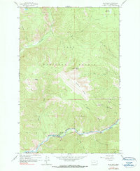
Editions of this 1965 Blue Point Map
2 editions found
Other maps of this area

1903 · Bonner
USGS Topo · 1:125,000

1921 · Elbow Lake
USGS Topo · 1:125,000

1947 · Butte
USGS Topo · 1:250,000

1955 · Choteau
USGS Topo · 1:250,000

1957 · Choteau
USGS Topo · 1:250,000

1958 · Butte
USGS Topo · 1:250,000

1958 · Choteau
USGS Topo · 1:250,000

1960 · Butte
USGS Topo · 1:250,000

1962 · Choteau
USGS Topo · 1:250,000

1962 · Butte
USGS Topo · 1:250,000