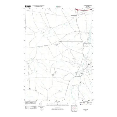
2010 Map of Clinton
USGS Topo · Published 2010About this map
Oriskany Creek defines the valley through this portion of Oneida County, anchoring established communities from Westmoreland in the north to Clinton and Franklin Springs in the south. The landscape is a mix of agricultural heritage and academic presence, notable for College Hill and the surrounding grounds of Kirkland Glen. Local history and genealogy are well-represented by a high density of burial grounds, including the Westmoreland Cemetery, Evergreen Cemetery, and the Kirkland Prospect Hill Cemetery. The mapping of small settlements like Hecla, Lairdsville, and Farmers Mills indicates a pattern of decentralized rural industry and crossroad hamlets. Waterways such as Deans Creek and Turkey Creek feed into the Oriskany, illustrating the drainage system that supported early New York farmsteads like Fairway Farm and Oriskany Creek Farm.
Find a feature on this map
87 named features on this map. Tap any name to fly to it.
Don’t see what you’re looking for? This feature index may not catch every label — zoom into the map to look around manually.
Map Details
Editions of this 2010 Clinton Map
This is the sole edition of this map. No revisions or reprints were ever made.
Other maps of this area

1895 · Oriskany
USGS Topo · 1:62,500

1895 · Oneida
USGS Topo · 1:62,500

1898 · Oneida
USGS Topo · 1:62,500

1898 · Oriskany
USGS Topo · 1:62,500

1902 · Morrisville
USGS Topo · 1:62,500

1902 · Oneida
USGS Topo · 1:62,500

1907 · Sangerfield
USGS Topo · 1:62,500

1939 · Oneida
USGS Topo · 1:62,500

1943 · Cassville
USGS Topo · 1:24,000

1943 · Sangerfield
USGS Topo · 1:62,500