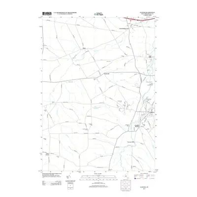
2013 Map of Clinton
USGS Topo · Published 2013About this map
Hamilton College sits at the heart of this landscape, its campus overlooking the surrounding hills and valleys of Oneida County. The map details a dense network of early 21st-century settlements and agricultural land, where places like Franklin Springs and Clark Mills represent the region's enduring small-town character. The topography is defined by prominent rises such as Prospect Hill and Christmas Knob, with the Oriskany Creek and Deans Creek winding through the lowlands. Local history is deeply etched into the terrain through numerous cemeteries, including Westmoreland Cemetery and the Kirkland Prospect Hill Cemetery, which serve as permanent records of the area's families and genealogy. The presence of Farmers Mills and various farmsteads like Windex Farms and Hinman Farms underscores the area's continued reliance on its productive soil and waterway proximity.
Find a feature on this map
121 named features on this map. Tap any name to fly to it.
Don’t see what you’re looking for? This feature index may not catch every label — zoom into the map to look around manually.
Map Details
Editions of this 2013 Clinton Map
This is the sole edition of this map. No revisions or reprints were ever made.
Other maps of this area

1895 · Oriskany
USGS Topo · 1:62,500

1895 · Oneida
USGS Topo · 1:62,500

1898 · Oneida
USGS Topo · 1:62,500

1898 · Oriskany
USGS Topo · 1:62,500

1902 · Morrisville
USGS Topo · 1:62,500

1902 · Oneida
USGS Topo · 1:62,500

1907 · Sangerfield
USGS Topo · 1:62,500

1939 · Oneida
USGS Topo · 1:62,500

1943 · Cassville
USGS Topo · 1:24,000

1943 · Sangerfield
USGS Topo · 1:62,500