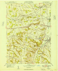
1949 Map of Clinton
USGS Topo · Published 1949About this map
Hamilton College and its landmark College Hill anchor the terrain of this Oneida County landscape just after the war. The map documents a sophisticated educational and agricultural network centered around the Oriskany Creek valley, where the village of Clinton serves as a local hub. Significant transportation routes like the Seneca Turnpike and the Ontario and Western line intersect with smaller rural communities like Franklin Springs and Clark Mills.
Find a feature on this map
49 named features on this map. Tap any name to fly to it.
Don’t see what you’re looking for? This feature index may not catch every label — zoom into the map to look around manually.
Map Details
Editions of this 1949 Clinton Map
This is the sole edition of this map. No revisions or reprints were ever made.
Other maps of this area

1895 · Oriskany
USGS Topo · 1:62,500

1895 · Oneida
USGS Topo · 1:62,500

1898 · Oneida
USGS Topo · 1:62,500

1898 · Oriskany
USGS Topo · 1:62,500

1902 · Morrisville
USGS Topo · 1:62,500

1902 · Oneida
USGS Topo · 1:62,500

1907 · Sangerfield
USGS Topo · 1:62,500

1939 · Oneida
USGS Topo · 1:62,500

1943 · Cassville
USGS Topo · 1:24,000

1943 · Sangerfield
USGS Topo · 1:62,500