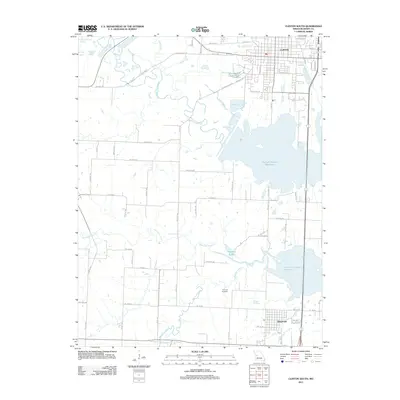
2011 Map of Clinton South
USGS Topo · Published 2011About this map
The Harry S Truman Reservoir dominates the eastern half of this landscape, its complex shoreline reaching into the drainage basins of the South Grand River and Deepwater Creek. This area in Henry County reflects a significant hydrologic transformation, where the reservoir's fingers interleave with the existing road grid of rural Missouri. To the north, the southern edge of Clinton shows an organized street network including Martin Village Rd and Artesian Ave, while the town of Deepwater sits at the southern edge of the reservoir's reach.
Find a feature on this map
41 named features on this map. Tap any name to fly to it.
Don’t see what you’re looking for? This feature index may not catch every label — zoom into the map to look around manually.
Map Details
Editions of this 2011 Clinton South Map
This is the sole edition of this map. No revisions or reprints were ever made.
Other maps of this area

1887 · Clinton
USGS Topo · 1:125,000

1894 · Clinton
USGS Topo · 1:125,000

1941 · Lowry City
USGS Topo · 1:24,000

1945 · Lowry City
USGS Topo · 1:24,000

1947 · Jefferson City
USGS Topo · 1:250,000

1953 · Gaines
USGS Topo · 1:24,000

1953 · Montrose
USGS Topo · 1:24,000

1953 · Hartwell
USGS Topo · 1:24,000

1953 · Clinton South
USGS Topo · 1:24,000

1953 · Calhoun West
USGS Topo · 1:24,000