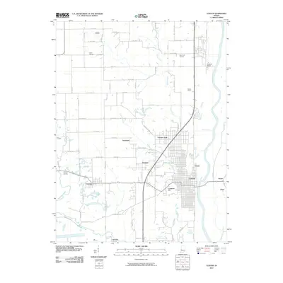
2010 Map of Clinton
USGS Topo · Published 2010About this map
The Wabash River meanders along the eastern boundary of this Vermillion County landscape, serving as the primary geographical anchor for the city of Clinton. The town's grid expands westward from the riverbanks toward Crompton Hill, while several outlying settlements such as Fairview Park, Klondyke, and Centenary illustrate the historical distribution of smaller communities in this region. The map reveals a high density of burial grounds including Riverview Cemetery and the more remote Helts Prairie Cemetery, providing valuable data for genealogical research.
Find a feature on this map
75 named features on this map. Tap any name to fly to it.
Don’t see what you’re looking for? This feature index may not catch every label — zoom into the map to look around manually.
Map Details
Editions of this 2010 Clinton Map
This is the sole edition of this map. No revisions or reprints were ever made.
Other maps of this area

1947 · Ridge Farm
USGS Topo · 1:62,500

1947 · Paris
USGS Topo · 1:62,500

1949 · Paris
USGS Topo · 1:62,500

1950 · Rosedale
USGS Topo · 1:24,000

1950 · New Goshen
USGS Topo · 1:24,000

1950 · Sandford
USGS Topo · 1:24,000

1951 · Clinton
USGS Topo · 1:24,000

1951 · Mecca
USGS Topo · 1:24,000

1951 · Saint Bernice
USGS Topo · 1:24,000

1953 · Indianapolis
USGS Topo · 1:250,000