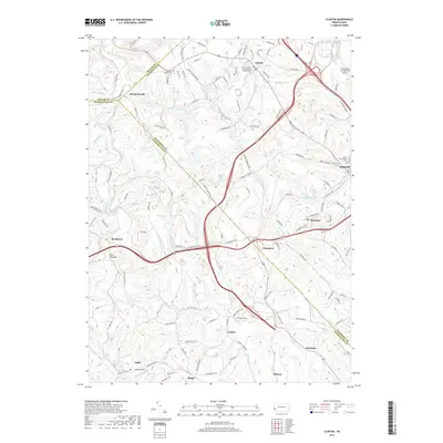
2019 Map of Clinton
USGS Topo · Published 2019About this map
Raccoon Creek and its many tributaries, including Wingfield Run and Chamberlain Run, carve a dense network of valleys across this intersection of Beaver, Allegheny, and Washington Counties. The landscape is defined by small, dispersed settlements like Murdocksville, Champion, and Bavington, often connected by historic routes such as the Steubenville Pike. Local heritage is preserved at sites like the Hopewell - Hebron Cem and the Clinton United Presbyterian Church Cem, which serve as anchors for the rural communities surrounding Clinton.
Find a feature on this map
108 named features on this map. Tap any name to fly to it.
Don’t see what you’re looking for? This feature index may not catch every label — zoom into the map to look around manually.
Map Details
Editions of this 2019 Clinton Map
This is the sole edition of this map. No revisions or reprints were ever made.
Other maps of this area

1901 · Beaver
USGS Topo · 1:62,500

1904 · Beaver
USGS Topo · 1:62,500

1904 · Carnegie
USGS Topo · 1:62,500

1904 · Burgettstown
USGS Topo · 1:62,500

1906 · Burgettstown
USGS Topo · 1:62,500

1906 · Carnegie
USGS Topo · 1:62,500

1906 · Sewickley
USGS Topo · 1:62,500

1908 · Sewickley
USGS Topo · 1:62,500

1908 · Carnegie
USGS Topo · 1:62,500

1951 · Canton
USGS Topo · 1:250,000
Featured Places
- Independence Township, PA
- Robinson Township, PA
- Clinton, Findlay Township
- Bavington, Smith Township
- Candor, Robinson Township