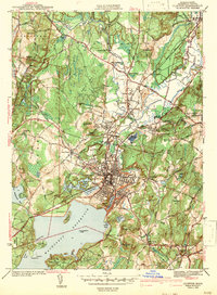
1943 Map of Clinton
USGS Topo · Published 1943About this map
Clinton and the surrounding Worcester County townships appear at a pivotal mid-century moment, dominated by the sprawling Wachusett Reservoir to the south and the industrial corridor of the Nashua River to the north. This survey, updated just before the mid-1940s, reveals a landscape defined by significant institutional and infrastructure footprints. Education and public works are prominent, from Atlantic Union College in South Lancaster to the State Industrial Sch near Still River.
Find a feature on this map
72 named features on this map. Tap any name to fly to it.
Don’t see what you’re looking for? This feature index may not catch every label — zoom into the map to look around manually.
Map Details
Editions of this 1943 Clinton Map
3 editions found
Other maps of this area

1885 · Worcester
USGS Topo · 1:62,500

1886 · Worcester
USGS Topo · 1:62,500

1887 · Marlboro
USGS Topo · 1:62,500

1887 · Fitchburg
USGS Topo · 1:62,500

1889 · Marlboro
USGS Topo · 1:62,500

1889 · Fitchburg
USGS Topo · 1:62,500

1892 · Worcester
USGS Topo · 1:62,500

1893 · Fitchburg
USGS Topo · 1:62,500

1893 · Groton
USGS Topo · 1:62,500

1896 · Marlboro
USGS Topo · 1:62,500