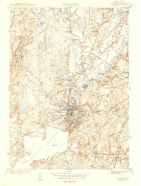
1943 Map of Clinton
USGS Topo · Published 1943About this map
The Nashua River valley dominates this wartime landscape, anchored by the dense industrial and residential layout of Clinton. Just south of the town center, the massive Wachusett Reservoir defines the geography, with its irregular shoreline creating Prescott Cove and Hastings Cove. This mid-century survey illustrates the vital rail connections of the era, including the Boston and Maine Railroad passing through Pratt Junction and the NY NH and H RR serving West Berlin.
Find a feature on this map
76 named features on this map. Tap any name to fly to it.
Don’t see what you’re looking for? This feature index may not catch every label — zoom into the map to look around manually.
Map Details
Editions of this 1943 Clinton Map
3 editions found
Other maps of this area

1885 · Worcester
USGS Topo · 1:62,500

1886 · Worcester
USGS Topo · 1:62,500

1887 · Marlboro
USGS Topo · 1:62,500

1887 · Fitchburg
USGS Topo · 1:62,500

1889 · Marlboro
USGS Topo · 1:62,500

1889 · Fitchburg
USGS Topo · 1:62,500

1892 · Worcester
USGS Topo · 1:62,500

1893 · Fitchburg
USGS Topo · 1:62,500

1893 · Groton
USGS Topo · 1:62,500

1896 · Marlboro
USGS Topo · 1:62,500