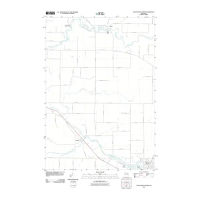
2010 Map of Clintonville North
USGS Topo · Published 2010About this map
The Embarrass River and its complex network of tributaries define the landscape of northern Waupaca County. This survey shows the rural settlement of Pella situated along the river, where the Pella 1882c38 Dam and the Hayman Falls WP 94-18 Dam indicate a history of water-powered infrastructure. Further south, the map details the terrain around Buckbee and the flowing waters of the North Branch Pigeon River, which eventually feeds into Pigeon Lake near the edge of the quadrangle. The presence of the Saint Martin Cemetery and numerous family-named roads, such as Magolski Rd and Kratzke Rd, provides significant data for genealogists tracing early residents of this agricultural region. The landscape transition from river valleys to landmarks like Picnic Point offers a clear view of the area's natural and human-made landmarks just after the first decade of the millennium.
Find a feature on this map
60 named features on this map. Tap any name to fly to it.
Don’t see what you’re looking for? This feature index may not catch every label — zoom into the map to look around manually.
Map Details
Editions of this 2010 Clintonville North Map
This is the sole edition of this map. No revisions or reprints were ever made.
Other maps of this area

1954 · Gresham
USGS Topo · 1:48,000

1954 · Shawano
USGS Topo · 1:48,000

1955 · Embarrass
USGS Topo · 1:48,000

1955 · Clintonville
USGS Topo · 1:48,000

1955 · Green Bay
USGS Topo · 1:250,000

1964 · Shawano
USGS Topo · 1:62,500

1964 · Gresham
USGS Topo · 1:62,500

1969 · Embarrass
USGS Topo · 1:24,000

1969 · Bear Creek
USGS Topo · 1:24,000

1970 · Clintonville North
USGS Topo · 1:24,000