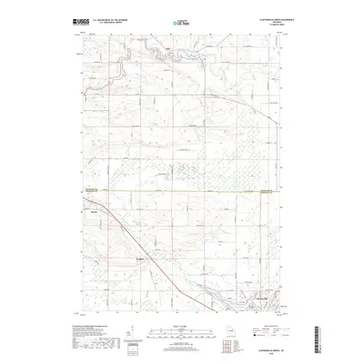
2018 Map of Clintonville North
USGS Topo · Published 2018About this map
Clintonville serves as the primary hub in this area of central Wisconsin, where the city's northern edge meets the tranquil waters of Pigeon Lake and the Pigeon River. The landscape is defined by its complex hydrology, featuring the meandering Embarrass River near the settlement of Pella in the north and the extensive Pella Swamp further east. This 2018 survey reveals a rural structure of family-named roads and small crossroads settlements, including the early township sites of Marion and Buckbee. Geologists and local historians can trace the course of the North Pigeon River and South Branch Pigeon River as they converge toward the urban center. Cultural landmarks like Saint Martin Cem and the recreational geography of Picnic Point illustrate the long-standing community ties to the land, while the boundary line between Shawano Co and Waupaca Co splits the quadrangle horizontally.
Find a feature on this map
85 named features on this map. Tap any name to fly to it.
Don’t see what you’re looking for? This feature index may not catch every label — zoom into the map to look around manually.
Map Details
Editions of this 2018 Clintonville North Map
This is the sole edition of this map. No revisions or reprints were ever made.
Other maps of this area

1954 · Gresham
USGS Topo · 1:48,000

1954 · Shawano
USGS Topo · 1:48,000

1955 · Embarrass
USGS Topo · 1:48,000

1955 · Clintonville
USGS Topo · 1:48,000

1955 · Green Bay
USGS Topo · 1:250,000

1964 · Shawano
USGS Topo · 1:62,500

1964 · Gresham
USGS Topo · 1:62,500

1969 · Embarrass
USGS Topo · 1:24,000

1969 · Bear Creek
USGS Topo · 1:24,000

1970 · Clintonville North
USGS Topo · 1:24,000