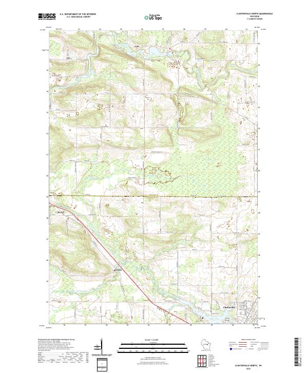
2022 Map of Clintonville North
USGS Topo · Published 2022About this map
The Embarrass River meanders through the northern portion of this landscape, anchoring the settlement of Pella, while the southern reaches are defined by the Pigeon River system near Clintonville. The transition between the Shawano Co and Waupaca Co border is marked by the expansive Pella Swamp and several tributary streams including Hydes Cr and Brandy Cr. Historically significant nodes such as Buckbee and Marion appear along the southwestern corridors, providing clear evidence of early 21st-century road networks and rural settlement patterns. Near the shore of Pigeon Lake, the Saint Martin Cem and Picnic Point stand as localized landmarks. This survey illustrates the persistent importance of the river drainage basins in shaping the layout of modern Wisconsin townships and rural intersections.
Find a feature on this map
95 named features on this map. Tap any name to fly to it.
Don’t see what you’re looking for? This feature index may not catch every label — zoom into the map to look around manually.
Map Details
Editions of this 2022 Clintonville North Map
This is the sole edition of this map. No revisions or reprints were ever made.
Other maps of this area

1954 · Gresham
USGS Topo · 1:48,000

1954 · Shawano
USGS Topo · 1:48,000

1955 · Embarrass
USGS Topo · 1:48,000

1955 · Clintonville
USGS Topo · 1:48,000

1955 · Green Bay
USGS Topo · 1:250,000

1964 · Shawano
USGS Topo · 1:62,500

1964 · Gresham
USGS Topo · 1:62,500

1969 · Embarrass
USGS Topo · 1:24,000

1969 · Bear Creek
USGS Topo · 1:24,000

1970 · Clintonville North
USGS Topo · 1:24,000