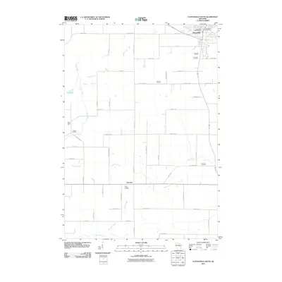
2010 Map of Clintonville South
USGS Topo · Published 2010About this map
Clintonville serves as the primary hub in this Waupaca County landscape, situated near the Clintonville 2WP268 Dam and the waters of Pigeon Lake. The area's rural character is defined by a dense network of family-named roads and agricultural landmarks like Maple Grove Farm, alongside the small settlement of Nicholson to the south. Genealogists will find this 2010 survey particularly valuable for its precise locations of several community burial grounds, including Graceland Cemetery, Saint Rose Cemetery, and the Trinity Lutheran Cemetery. The terrain is drained by a complex system of waterways, from the northern Pigeon River to the meandering southern reaches of Fountain Creek and Beaver Creek. This map reflects the long-standing layout of country routes such as County Hwy O and County Hwy T, which connect the scattered farmsteads and rural churches that have long anchored this Wisconsin township.
Find a feature on this map
53 named features on this map. Tap any name to fly to it.
Don’t see what you’re looking for? This feature index may not catch every label — zoom into the map to look around manually.
Map Details
Editions of this 2010 Clintonville South Map
This is the sole edition of this map. No revisions or reprints were ever made.
Other maps of this area

1955 · Embarrass
USGS Topo · 1:48,000

1955 · Clintonville
USGS Topo · 1:48,000

1955 · Green Bay
USGS Topo · 1:250,000

1956 · New London
USGS Topo · 1:48,000

1956 · Weyauwega
USGS Topo · 1:48,000

1969 · New London
USGS Topo · 1:24,000

1969 · Northport
USGS Topo · 1:24,000

1969 · Embarrass
USGS Topo · 1:24,000

1969 · Bear Creek
USGS Topo · 1:24,000
1969 · Manawa
USGS Topo · 1:24,000