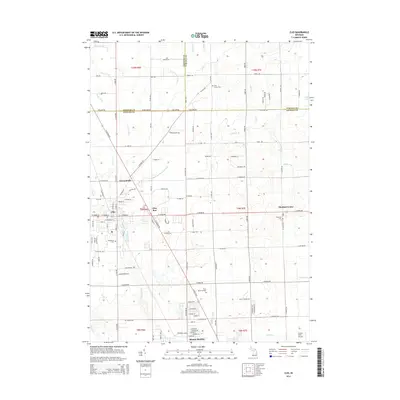
2014 Map of Clio
USGS Topo · Published 2014About this map
Clio and the surrounding Genesee County landscape are defined by a grid of agricultural fields and small residential clusters along the Saginaw and Tuscola county lines. This area shows a transition from the structured street plan of Mount Morris in the south to the more dispersed rural crossings of Thetford Center and Farrandville. The local hydrology is heavily managed, characterized by numerous drainage systems such as Silver Cr Drain, Bogart Drain, and Horton Graham Drain, which support the region's long-standing farming tradition. Genealogists will find significant value in the documentation of several local burial sites, including Woodlawn Cem, Thetford Cem, and Pine Grove Cem. Notable landmarks like Flint Memorial Park and the Duford Field Airport underscore the mix of community space and small-scale infrastructure that serves this portion of Michigan.
Find a feature on this map
128 named features on this map. Tap any name to fly to it.
Don’t see what you’re looking for? This feature index may not catch every label — zoom into the map to look around manually.
Map Details
Editions of this 2014 Clio Map
This is the sole edition of this map. No revisions or reprints were ever made.
Other maps of this area

1919 · Saginaw
USGS Topo · 1:62,500

1919 · Burt
USGS Topo · 1:62,500

1920 · Flint
USGS Topo · 1:62,500

1921 · Burt
USGS Topo · 1:62,500

1922 · Flint
USGS Topo · 1:62,500

1941 · Saginaw
USGS Topo · 1:62,500

1943 · Burt
USGS Topo · 1:62,500

1943 · Saginaw
USGS Topo · 1:62,500

1943 · Flint
USGS Topo · 1:62,500

1954 · Flint
USGS Topo · 1:250,000